
GEOINTeraction Colorado: Exploring Space-Based Thermal Insights
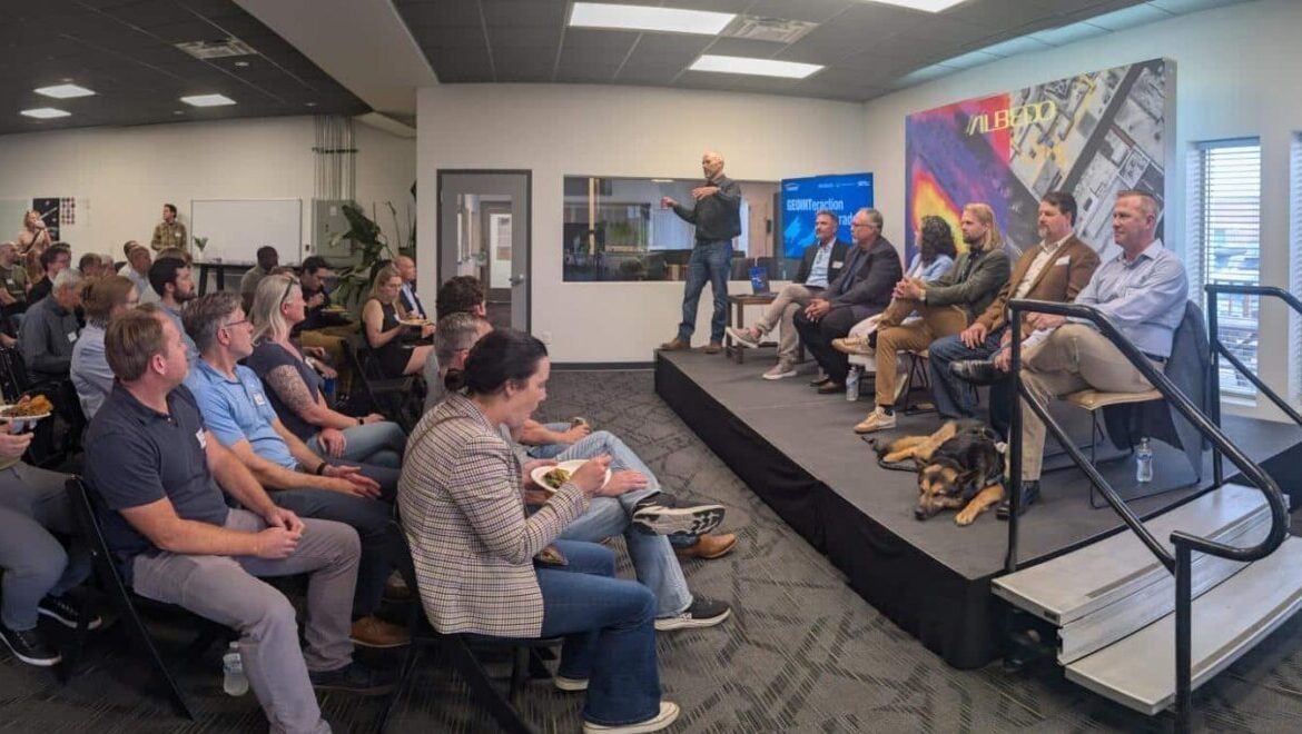
At USGIF’s June GEOINTeraction Colorado, USGIF’s Front Range Area Community (FRAC) of Interest gathered government and industry leaders for a discussion on space-based thermal sensing and its growing role in GEOINT.
Thermal imagery can seem intuitive at first glance, but its real value lies in what analysts and users can derive from the data.
That idea anchored USGIF’s June GEOINTeraction Colorado, held June 25 at Albedo Space in Broomfield, Colorado. The program, Thermal Insights from Space, brought together members of the Front Range geospatial community for a technical discussion on how commercial thermal sensing capabilities are evolving, where they can deliver value, and what users need to understand as a new generation of data becomes available.
The event was organized by FRAC, a USGIF Working Group that connects and supports the GEOINT, geospatial, and remote sensing community across Colorado and the broader Front Range region.
Sponsored by Albedo Space and SMX, the program marked USGIF’s second GEOINTeraction Colorado gathering, following the group’s inaugural event in March at Catalyst Campus in Colorado Springs.
Why Thermal, and Why Now
Commercial thermal capabilities are advancing quickly, creating new opportunities for GEOINT users as well as new questions around tradecraft, integration, and operational use.
The first generation of commercial imaging constellations is beginning to bring new thermal data sources to market, creating opportunities for users across national security, civil, commercial, and environmental missions. As those capabilities mature, the community has an opportunity to shape how thermal data is positioned, understood, and applied. The appeal of thermal sensing is straightforward: it helps users see what other sources cannot.
Long wave infrared and midwave infrared spectral responses can provide an intelligence dimension that is inaccessible to visible, near infrared, and synthetic aperture radar systems. Sensing temperature from space is technically complex, but the basic concept is intuitive. Objects have heat signatures, and those signatures can reveal patterns of activity that may not be visible through other collection methods.
From Heat Signatures to Mission Insight
The program brought together leaders from the commercial thermal sensing community and experienced government and industry voices for a candid conversation about what it will take to turn thermal data into usable intelligence.
FRAC Co-Chair Pierre Izard delivered introductory remarks along with Jim McCool, VP of Tradecraft at USGIF.
Panelists included:
- Dan Salisbury, Director, NGA Denver
- Tara Gattis, US Partnerships, constellr
- Hanna Steplewska, VP Sales, SatVu
- David Robinson, VP, US Government Programs, Hydrosat
- Nate McIntyre, Lead Engineer for Data Processing, Albedo Space; and
- FRAC Co-Chair KC Kroll as moderator.
Together, they explored the challenges and opportunities associated with bringing a new sensing layer to a user base already working to keep pace with growing volumes of electro-optical, synthetic aperture radar, and other remote sensing data.
The conversation made clear that early adopters of commercial thermal imaging data are likely to include the national security community, as has often been the case with emerging commercial Earth observation capabilities. But the value of thermal sensing extends well beyond traditional defense and intelligence use cases.
Industrial activity, manufacturing activity, data center activity, and supply chain movement all have thermal signatures that can serve as economic indicators. Those insights may matter to a national security leader seeking geopolitical advantage, a civil agency monitoring infrastructure, or a commercial user evaluating market activity.
The panel also highlighted applications in wildfire response, agriculture, water resource management, and methane monitoring. These examples underscored the dual-use nature of thermal data and its potential to support decision-making across multiple sectors.

The Tradecraft Behind the Thermal Data
Thermal data can be powerful, but it requires careful interpretation.
One of the strongest themes from the discussion was the need for education. Users need to understand that not all thermal data is the same. Long wave infrared and midwave infrared sensors can behave differently, support different use cases, and carry different limitations. The distinction matters.
Ignoring radiometry and thermometry can also introduce risk. Thermal sensing can produce powerful insights, but only when users understand what the data can reliably show, what it cannot show, and what assumptions are being made in analysis.
The discussion also reinforced the importance of GEOINT tradecraft. Commercial providers introducing new or experimental sensing capabilities should be transparent about the maturity, limitations, and confidence levels associated with their data and derived insights. Much like intelligence analysts qualify their findings when sources or methods are not fully vetted, commercial partners should help users understand how to interpret emerging capabilities responsibly.
That transparency must go both ways. Government users also need to be willing to iterate with commercial mission partners and accept reasonable risk when emerging capabilities show clear intelligence value. In many cases, data does not need to be perfect to be useful. The challenge is knowing how to apply it appropriately.
Data Fusion, AI, and the Next Phase of Exploitation
The discussion also pointed toward the next phase of thermal sensing adoption: making thermal data easier to combine, query, and exploit alongside other GEOINT sources.
As new commercial sources become available, users will need thermal data that is fusion-ready and accessible within broader analytic workflows. The value of thermal sensing will increase when it can be integrated with other sources such as electro-optical imagery, SAR, LiDAR, and additional geospatial data layers.
Artificial intelligence and machine learning will also play an important role. Like many GEOINT domains, thermal imagery can benefit from applied AI, particularly computer vision models that can help extract patterns, detect change, and scale analysis across large datasets.
The panel noted that thermal data still trails other imagery types in AI-enabled exploitation. Closing that gap will require training data, model development, user feedback, and continued collaboration between data providers, analysts, and mission users.
Large language models may not yet understand geography with the reliability required for many GEOINT applications, but they may still support parts of the workflow, including helping design, train, or accelerate more traditional computer vision approaches. The opportunity is not simply to apply AI for its own sake, but to use automation and analytic tools where they can help users extract reliable insight at scale.
A Conversation Worth Continuing
Thermal sensing is an emerging intelligence layer with the potential to support faster, more informed decisions across national security, civil, commercial, and environmental missions, but technology alone is not enough. To realize the value of thermal sensing, the community will need strong tradecraft, transparent communication, user education, data integration, and sustained collaboration between government, industry, academia, and mission partners.
For those interested in learning more about thermal sensing, Earth observation, and related applications, FRAC recommends the following resources:
- 18th Annual Quantitative InfraRed Thermography Conference: https://qirt2026.unina.it/event/1/
- Colorado School of Mines Payne Institute Earth Observation Group: https://payneinstitute.mines.edu/eog/
- OroraTech: https://ororatech.com/
- Earth Fire Alliance: https://www.earthfirealliance.org/
FRAC will continue refining its gatherings, and welcomes suggestions for events, opportunities, or topics that would benefit the Front Range Area GEOINT community. Interested in being part of the conversation? Sign up to receive updates about FRAC and share your ideas with USGIF’s Front Range Area Community of Interest.
USGIF thanks participating panelists and attendees, with special thanks to Albedo Space and SMX for sponsoring the June GEOINTeraction Colorado event and supporting continued collaboration across the Front Range GEOINT community.
For more information on FRAC and USGIF Working Groups, visit USGIF Working Groups.
Related Articles

USGIF Welcomes Civil Air Patrol
Herndon, Virginia (July 2, 2026) – The United States Geospatial Intelligence Foundation (USGIF) is pleased to announce Civil Air Patrol (CAP) has joined USGIF a…

Turning Maritime Awareness Into Decision Advantage
At USGIF’s June GEOINTeraction Tuesday, U.S. Coast Guard Assistant Commandant for Intelligence Steven Griffin called for a faster “detect-to-act” approach to ma…

USGIF Working Groups Welcome New Leaders
We’re excited to announce new leadership across two USGIF Working Groups. Following its launch at GEOINT Symposium 2026, the Maritime Domain Awareness Working…