
Interested in helping shape what’s next?
Fill out the form to learn more
Next Meeting:
Purpose
The Education Working Group serves to unite the many levels of education that USGIF supports. The EWG brings together educators from higher education, primary and secondary schools, as well as members of the nonprofit community and other educational spaces to better produce and communicate GEOINT thinking, skills, and methods in classroom settings, enhance the student and educator experience, and demonstrate the importance of integrating modern GEOINT into curriculum. This group aims to advance all three USGIF pillars: build the community, advance the tradecraft, and accelerate innovation.
Objectives
-
Educational Standards and Resources:
-
Develop standardized definitions and frameworks for GEOINT education
-
Assist in updating the USGIF’s Essential Body of Knowledge (EBK) bi-annually.
-
Support gamification initiatives for GEOINT learning across primary and secondary schools.
-
-
Higher Education Initiatives:
-
Provide subject matter experts (SMEs) for accreditation processes and site visits.
-
Create shared materials and lesson plans for teaching GEOINT in higher education.
-
Facilitate outlets for publishing academic and student research.
-
-
Primary and Secondary Education Support:
-
Establish a talent pipeline by connecting secondary educators with higher education institutions.
-
Develop and distribute teaching resources for secondary and primary educators.
-
Produce educational tools such as seminars, videos, and gamified challenges on GEOINT topics.
-
Provide guidance on accessing open-source resources for classroom use.
-
-
Community and Industry Engagement:
-
Foster collaboration between academia, industry, and government to support student research and innovation.
-
Promote partnerships that integrate GEOINT into interdisciplinary learning experiences.
-
Host/support cooperative and competitive GEOINT themed events (i.e., hack-a-thon type events)
-
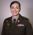
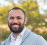
Co-chairs

2026 GEOINT Student Briefs
M23 is Likely to Use Drones to Protect Its Mining Infrastructure by 2028
Overflowing Barrels, Failing Foundations: The Collapse of Venezuela’s Oil State
- Assessing Landscape Transformation in Western North Carolina Due to Hurricane Helene 2024 Using Sentinel-2 High Resolution Multispectral Imagery
- Foreign Investment in the United States: Assessing Multi-Scale Geospatial Risk
- Does Adding an Elevation Layer Make a Meaningful Difference in Land Cover Classification Accuracy?
- Remote Sensing the Past: Declassified CORONA and HEXAGON Imagery as a Tool for Locating MIA Airmen Lost Over Laos During the Vietnam War
- Advancing Space Situational Awareness and Geospatial Intelligence Through Density-Based Clustering Utilizing Machine Learning
Upcoming Meetings & Events
There are currently no upcoming events.
Don’t Just Join the Conversation. Help Shape It.
USGIF Working Groups bring members together to connect with GEOINT leaders, contribute expertise, shape thought leadership, and stay ahead of what’s next across the community.