GEOINT Foreword 2026: Setting the Stage Through Science, Research, and Mission Focus
Monday, May 4, 2026/Rebecca Rutberg
GEOINT Foreword, May 3, 2026, marked the opening chapter of GEOINT Symposium 2026, May 3-6, in Aurora, Colorado, bringing the community together for a day grounded in science, research, and forward‑looking perspectives. Designed as a preconference program, Foreword created space for deeper examination of the foundational forces shaping geospatial intelligence, from mission‑driven science and workforce development to autonomy in contested environments.
Across keynotes, panels, and student engagements, the conversations underscored a consistent message: advancing GEOINT capability depends on rigorous research, adaptable technology, and sustained collaboration across government, industry, and academia.
Opening Keynote: Brett Markham, Deputy Director, NGA
GEOINT Foreword opened with a keynote from Brett Markham, Deputy Director of the National Geospatial‑Intelligence Agency (NGA), who offered a clear-eyed look at the evolving mission demands facing the GEOINT enterprise.
Markham spoke to the increasing complexity and pace of today’s operational environment, emphasizing the need to move from experimentation to deployment at scale, particularly in areas such as AI, automation, and data integration. He highlighted the central role of the workforce and partnerships in enabling decision advantage, reinforcing that progress requires both technical innovation and institutional alignment.
His remarks set the tone for the day, framing GEOINT Foreword as a forum for bridging foundational research with operational reality.
Mission‑Driven Science: The National Labs’ Impact on GEOINT
The panel “Mission‑Driven Science: The National Labs’ Impact on GEOINT” examined how applied research translates into operational capability across the GEOINT mission space.
Moderated by Budhu Bhaduri, Chief Data Officer at Oak Ridge National Laboratory, the panel featured:
Jerriann Garcia, Program Director, Space Mission Program, Sandia National Laboratories
Carter Christopher, Ph.D., Director, Geospatial Science and Human Security Division, Oak Ridge National Laboratory
Adam Attarian, Senior Data Scientist, Pacific Northwest National Laboratory
Panelists discussed the unique role the National Labs play in bridging basic research and operational use, leveraging specialized infrastructure, long‑term investment, and multidisciplinary expertise to address challenges that extend beyond commercial or academic boundaries alone. The conversation highlighted how advanced sensing, AI‑enabled analytics, population modeling, and resilient space technologies are already supporting GEOINT missions today.
Building the GEOINT Workforce of the Future
Workforce development was a central theme of GEOINT Foreword, explored in the panel “The Blueprint for the GEOINT Workforce of the Future.”
Moderated by Treva Smith, Director of the National Geospatial‑Intelligence College at NGA, the panel brought together academic leaders to examine how education and training must evolve alongside mission needs:
Jack Cothran, Ph.D., Professor, University of Arkansas
Robert Griffin, Ph.D., Associate Professor, Atmospheric & Earth Science, University of Alabama in Huntsville
Ayman Habib, Ph.D., Professor of Civil Engineering, Purdue University
John Wilson, Ph.D., Director, GEOINT Program, University of Southern California
Panelists emphasized operational relevance, interdisciplinary education, and the integration of AI alongside strong foundational geospatial science. The discussion reinforced that preparing the next generation of GEOINT professionals requires deliberate coordination across academia, government, and industry.
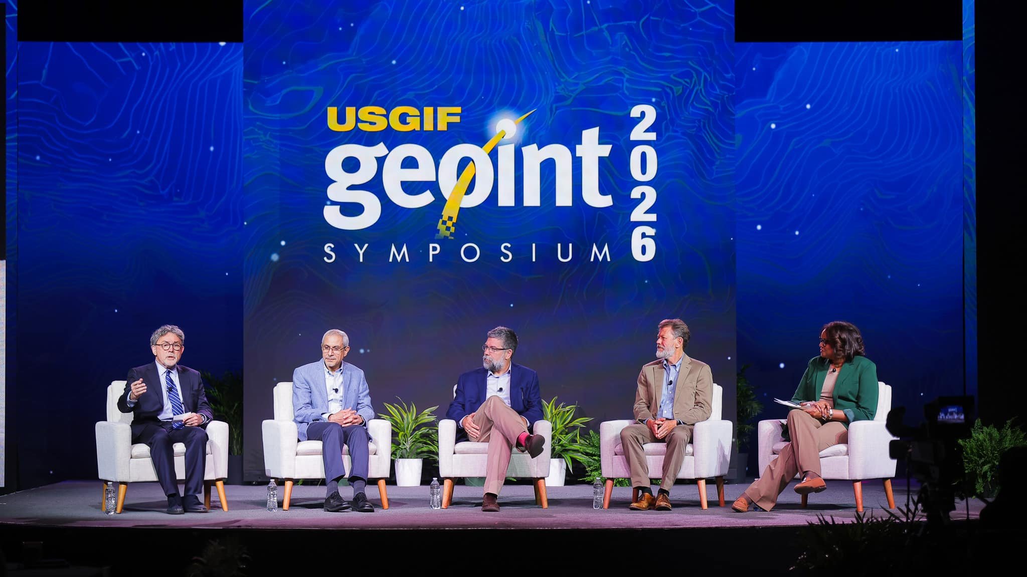
Resilient Autonomy in GPS‑Denied Environments
The panel “Resilient Autonomy in a GPS‑Denied Environment” addressed one of the most technically and operationally complex challenges facing GEOINT and defense communities today.
Moderated by Michael Robbins, President and CEO of the Association for Uncrewed Vehicle Systems International (AUVSI), the panel featured:
Nick Bousquet, Vice President of Strategy, GRVTY
Hugh Hayden, Head of Go‑To‑Market, Niantic Spatial
Damien Tyrrell, Regional Director, Robotics & Autonomous Systems, Shield AI
Drawing on real‑world operational experience, panelists focused on trust, adaptability, and data confidence as essential elements of autonomy under contested conditions. The conversation highlighted multi‑sensor fusion, state estimation, and system designs built to operate with uncertainty, rather than attempting to eliminate it.
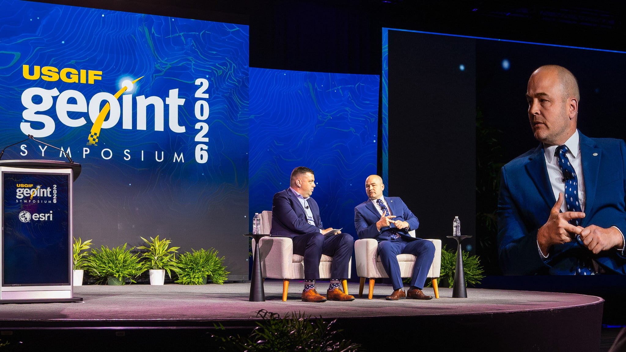
Keynote: Stephen Winchell, Director, DARPA
GEOINT Foreword concluded with a keynote and audience Q&A from Stephen Winchell, Director of the Defense Advanced Research Projects Agency (DARPA), who reflected on DARPA’s longstanding role in shaping geospatial intelligence. Winchell focused on a pivotal moment driven by sharply reduced costs to orbit and the expanding role of private‑sector innovation, outlining how DARPA’s emerging space strategy and high‑risk, high‑reward research continue to influence GEOINT across sensors, data pipelines, AI, and decision systems.
Following his remarks, Winchell engaged directly with attendees in a moderated discussion led by Jeff Dawley of Esri, expanding on DARPA’s approach to experimentation, risk tolerance, and partnership across government, industry, and academia. He emphasized that GEOINT’s progress has consistently been enabled by bold technical bets and a willingness to learn through failure—principles that remain central to DARPA’s mission today.
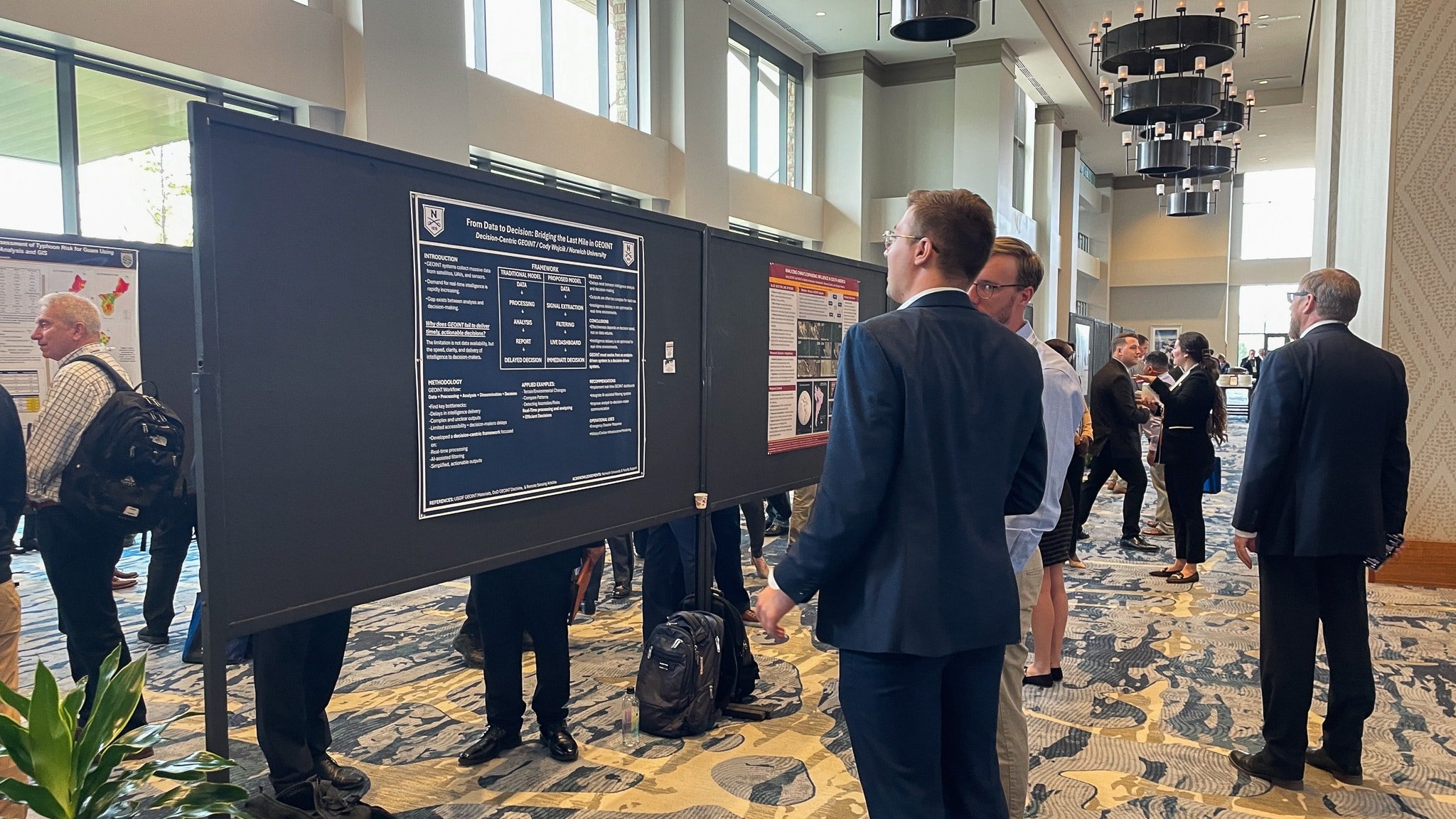
Student Engagement and the Poster Competition
GEOINT Foreword underscored how student research and early‑career scholarship continue to shape the GEOINT enterprise.
That theme was reflected in a keynote from Amanda Fetch, Ph.D., the GEOINT 2025 Poster Session Winner, who highlighted the growing challenge of space debris and the need for scalable analytic approaches to assess and mitigate risk.
Throughout the day, this trajectory was reinforced by the student poster sessions, which showcased innovative research and applied approaches from academic institutions nationwide. The breadth and rigor of the work on display highlighted both technical excellence and a strong alignment with real‑world GEOINT challenges.
This focus culminated in the announcement of the 2026 Poster Competition winners, whose work demonstrated analytical depth, originality, and clear relevance to the GEOINT mission.
2026 Poster Competition Winners
First Place
Forecasting Threats to Critical Mining by M23 in the Democratic Republic of Congo Abigail Gorman, Lindsay Toothaker, Savannah Dorey — James Madison University
Second Place
From Parcels to Policy: A Geospatial Framework for Assessing Foreign Land Ownership Near Critical Infrastructure Laura Wieland and Ishmael Legaspi — University of Southern California
Third Place (Tie)
Multi‑Scale Remote Sensing Techniques for Improved Mapping and Prediction of Flooding: From Beachfront to Urban Environments Samantha Velasco — Bethune Cookman University
Operational SAR Shoreline Extraction Using Deep Learning Jeremy Dougherty — Metropolitan State University of Denver
In keeping with tradition, the first‑place winners will be invited back next year to deliver a keynote at GEOINT Foreword in Kissimmee, Florida
Looking Ahead
GEOINT Foreword provided a focused, substantive foundation for the days ahead, emphasizing that GEOINT advancement begins with science, research, and people. As GEOINT 2026 moves into its main programming, the conversations from Foreword will continue to inform the dialogue around innovation, mission execution, and the future of geospatial intelligence.
Thank you to everyone who contributed to GEOINT Foreword—speakers, panelists, students, and attendees, with special thanks to Esri, the sponsor of GEOINT Foreword, and our emcees for the day, Jeff Dawley, USGIF Board Member and Director of Intelligence Business Development at Esri, and Tara Mott, Senior Account Manager, Esri.
We are excited to build on this momentum as GEOINT Symposium 2026 gets underway tomorrow.
HERNDON, Va. (July 15, 2026) — The United States Geospatial Intelligence Foundation (USGIF) and Delta State University have announced the reaccreditation of De…
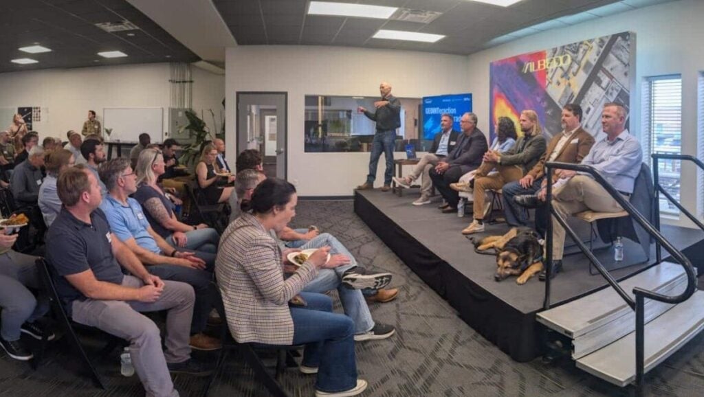
At USGIF’s June GEOINTeraction Colorado, USGIF’s Front Range Area Community (FRAC) of Interest gathered government and industry leaders for a discussion on spac…
Herndon, Virginia (July 2, 2026) – The United States Geospatial Intelligence Foundation (USGIF) is pleased to announce Civil Air Patrol (CAP) has joined USGIF a…