

Forging the Future of GEOINT: Interoperability, AI, and Global Collaboration Take Center Stage
The second day of the 2025 GEOINT Symposium highlighted evolving challenges in geospatial intelligence, with a focus on the need for interoperability, integration of artificial intelligence, and collaboration across sectors, and of AI in transforming GEOINT workflows, emphasizing its potential to enhance decision-making and improve mission outcomes.
Johnny Sawyer, former Chief of Staff for the Defense Intelligence Agency, Founder of The Sawyer Group, and a member of USGIF’s board of directors, opened the morning with some observations on the significance of holding events such as this one that bring diverse members of the geospatial intelligence community together.
“For decades, GEOINT was primarily driven by government agencies, relying on our own satellites, our own analysts, and carefully collected and curated data,” he observed. “But that landscape has shifted. Today’s threats are more complex, the volume of data is staggering, and innovation is moving at a dizzying pace.
“That’s where USGIF’s role as a convener becomes so powerful, bringing together government, academia, and industry. The private sector offers deep talent, cutting-edge technology, and an unrelenting drive for innovation. Academia brings rigorous research, forward-looking development, and the education of tomorrow’s workforce. And when government sets the strategic direction while industry and academia bring speed, insight, and creativity, the results are transformative.”
GEOINT Interoperability: Global Collaboration for Security
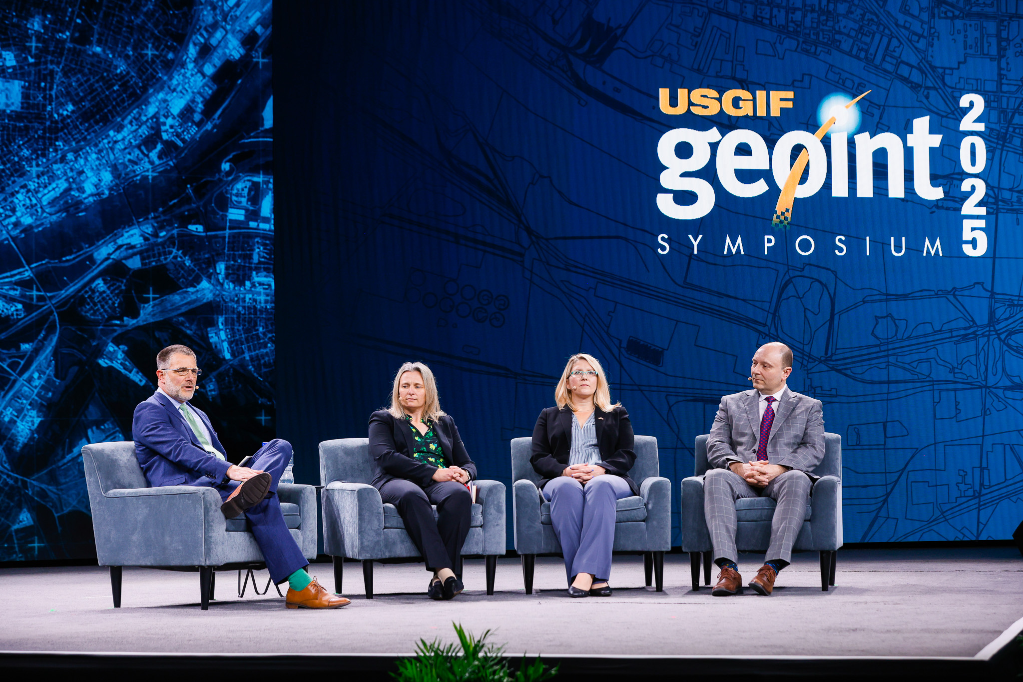
The day’s first panel focused on one of modern GEOINT’s most critical challenges: ensuring interoperability of systems and platforms in a rapidly evolving threat landscape. As data flows grow exponentially and global threats become more intricate, the imperative to “fight off the same map” has never been more urgent. Now more than ever, there’s a need for seamless integration that will let decision-makers act with a shared understanding of the operational environment.
Moderated by Jeff Builta, Senior Executive at the National Geospatial-Intelligence Agency, the panel brought together senior GEOINT leaders from key U.S. partners: Australia, Canada, and the United Kingdom. Their conversation emphasized the shared responsibility of governments, defense agencies, and commercial sectors to ensure efficient collaboration. As Builta pointed out,
“If we can’t operate as a team, if we cannot trust the work, the data, the architecture of those around us, then we’re going to have a hard time actually operating as an enterprise.”
Brigadier General Eric Vandenberg, Director General Intelligence Enterprise with the Canadian Forces Intelligence Command, noted this was true in all aspects of GEOINT. He pointed to two examples where various kinds of intelligence were pieced together to form a picture, both figurative and literal: amid the Cuban Missile Crisis, when reports of Russian activity and armaments less than 100 miles from U.S. shores were substantiated with the support of images, and in the aftermath of the 2010 earthquake in Haiti, where humanitarian aid could be more efficiently distributed thanks to combined reports from NGOs on the ground and satellite imagery.
“And it’s not just about visualization,” he added. “It’s really about the power that GEOINT has to enable that multidisciplinary intelligence picture. It allows decision makers, it allows commanders, it allows anyone within the realm of GEOINT to tell a compelling story. And I think that is really the power of GEOINT, and why I think it is the glue that holds together all of the other intelligence disciplines, not just for national security, but across all domains.”
Asked specifically to address the role of commercial GEOINT enterprises in assisting this mission, Katherine Davies, Senior UK GEOINT Officer with the UK Strategic Command, replied, “If we want to secure that interoperability, then we need to leverage all the amazing commercial offerings. Doing so allows us to exploit technological advances more quickly than we could have done alone. This can unlock faster response times. And, of course, it increases our resilience and our communal capabilities.”
And Melissa Best, Assistant Secretary of Intelligence and Insights with the Australia Geospatial Intelligence Organisation, picked up on Builta’s initial theme by noting that cohesion arises from building trusting relationships across all GEOINT sectors on an individual level. “Those analyst-to-analyst relationships, those teams that we build that can help each other through these processes, through lessons learned, are vital,” Best said. She then extended an invitation to everyone in the audience: “I would say for those of you that are sitting out there that have these ideas that can help us, you know, build the interoperability and develop the systems, please come and see me.”
Applying AI More Widely to GEOINT to Support Security
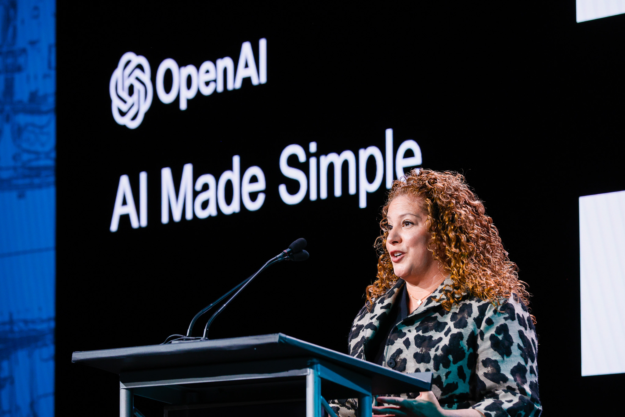
Katrina Mulligan, Head of National Security Policy and Partnerships at OpenAI, was the morning’s keynote speaker. Mulligan leads the company’s efforts to align advanced AI technologies with national security priorities, working closely with government, defense, and intelligence stakeholders to develop responsible AI frameworks. To do this, she applies an extensive background in national security law and policy; she has held senior roles in the Department of Justice, the Office of the Director of National Intelligence, and the National Security Council, as well as other positions across the intelligence community.
Mulligan’s keynote focused on making the often-complex world of AI tangible, specifically for those working in national security. She highlighted the recent rapid evolution of AI, moving from basic models to sophisticated reasoning systems capable of outperforming human experts in many areas. She emphasized that while AI’s pace may feel overwhelming, it presents an invaluable opportunity for transforming workflows, particularly in geospatial intelligence.
She encouraged those in the audience who are not regular users of AI to discover its GEOINT possibilities for themselves, saying,
“I love the analogy that you don’t get fit by reading about working out, and that’s true with AI too. You don’t get smart about AI without actually using the technology.”
True to this spirit, Mulligan used AI tools to demonstrate its progress and potential for the audience. She noted that AI’s leap from basic applications to advanced reasoning models has been transformative, enabling the technology to handle increasingly complex tasks, such as satellite image analysis, in real-time.
Mulligan emphasized the importance of governments keeping up with AI’s rapid development, warning that falling behind could leave the United States vulnerable to adversaries who are adopting the technology faster. She concluded by stressing the need for closer collaboration between the private sector, government, and like-minded nations to ensure that AI’s benefits are fully realized in national security applications.
“My ask of you today is to be open to updating your thinking on this technology,” Mulligan said. “And in particular, I want you to be open to the fact that the pace of this technology is being measured by a clock, not a calendar.”
AI’s Impact on GEOINT: Transforming Operations and Decision-Making
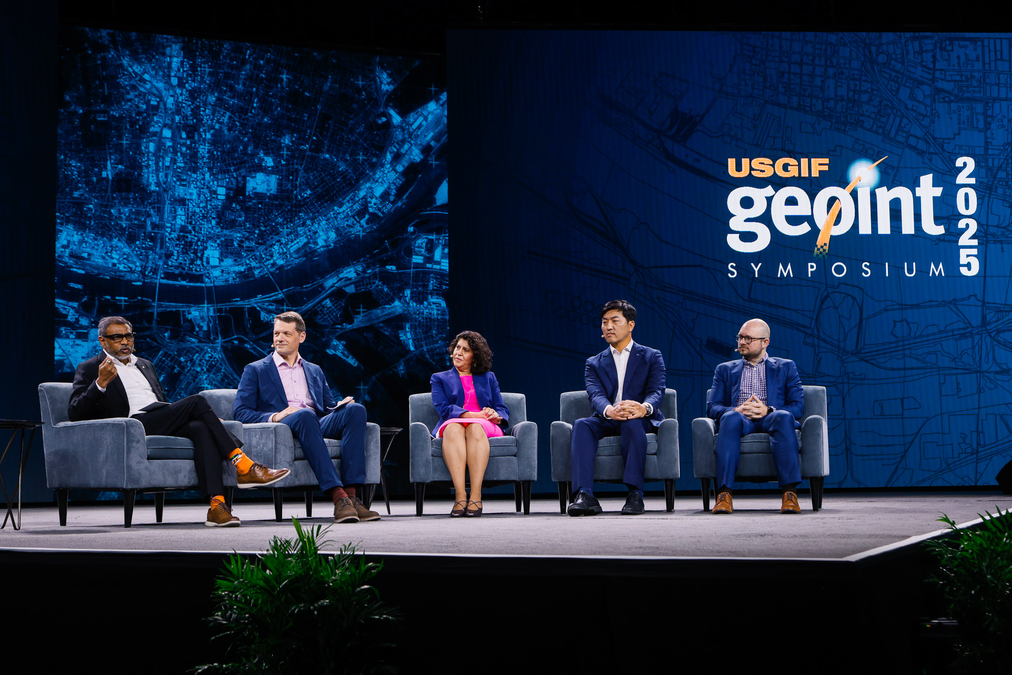
The final panel of the day delved into how artificial intelligence is already revolutionizing the GEOINT mission, from autonomous data processing to providing real-time decision support. Panelists shared valuable insights on the operationalization of AI, addressing key challenges such as managing ethical risks and accelerating mission outcomes through automation. With AI’s growing influence in shaping the future of geospatial intelligence, the discussion focused on the transformative potential of these technologies and the importance of integrating them into operational workflows.
Moderating the session was Dr. Sanjay Kumar, Chief Executive Officer of Geospatial World. Known for his role in accelerating the growth of the global geospatial industry, Dr. Kumar brought to the discussion a wealth of experience in raising awareness of the industry’s value and advocating for its strategic importance.
Panelists shared a range of perspectives, from the creative uses of AI as a thought partner to the rapid development of geospatial AI platforms by major tech companies. They spoke of how AI can enhance human workflows, drive collaboration, and support complex decision-making processes across various domains of GEOINT. They also addressed the importance of trust, transparency, and ethical considerations in deploying AI, particularly in national security contexts.
Taegyun Jeon, Founder & Chief Executive Officer of SI Analytics, discussed four main types of AI: perception AI, generative AI, agentic AI, and physical AI. He emphasized that geospatial foundation models are core to both generative AI and agentic AI. He explained that these models are not general models but must be mission-specific, tailored for geospatial applications.
Abe Usher, Co-Chief Executive Officer at Black Cape, said he turned to generative AI mostly to iterate on ideas:
“One thing where people don’t think creatively is sometimes they use generative AI like a Google search, and they’re just looking for a specific answer. I think a much more impactful way to use generative AI is to consider a thought partner. Instead of just asking a question, invite it to help you with your thinking.”
Nadine Alameh, Executive Director of the Taylor Geospatial Institute and previously CEO of the Open Geospatial Consortium, focused on collaboration in the evolving geospatial AI ecosystem, particularly the foundational work needed to build trust in AI and geospatial data, which is key to enabling smooth collaboration in the field. She noted:
“This community is doing what we call the boring work behind the scenes to ensure that the data is trusted.”
And Don Polaski, Vice President of AI for Intel at Booz Allen Hamilton, observed that as more GEOINT professionals experiment with and come to trust AI, they’ll find ways to apply it so that they’re better able to do their work. “
There’s so much energy behind this technology,” he said, “and I think what I’ve seen over the past couple of years is there have been a lot of pilots, a lot of prototypes, a lot of proofs of concept, and I think of those as little petri dishes, right? Everything’s moving so fast, so the pilot that you built six months ago is going to use different technologies than the one you would build today, but we’re starting to see proven results. We’re starting to see adoption of this technology.”
The panelists agreed that AI would not and should not replace human intelligence, but rather augment it, fostering a collaborative relationship between humans and AI. They explored the challenge of ensuring AI is accessible and useful at both the tactical and enterprise levels, emphasizing the need for standardization and governance models to maximize its potential. The discussion concluded with a recognition of AI’s growing role in shaping the future of geospatial intelligence, with a call for continued innovation, collaboration, and ethical practices in the deployment of this powerful technology.
Related Articles
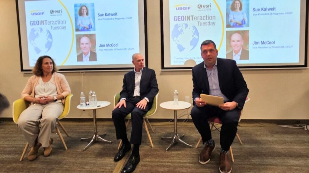
GEOINTeraction Tuesday: A Conversation with USGIF’s New VPs
On March 24, members of the GEOINT community gathered at Esri’s Tysons office for a special GEOINTeraction Tuesday featuring USGIF’s newly appointed Vice Presid…

GEOINTeraction Colorado: Data Standards, AI Integration, and the Skills That Keep GEOINT Mission-Ready
On March 19, 2026, USGIF convened the inaugural GEOINTeraction Colorado in Colorado Springs, bringing together industry professionals, Army personnel, and intel…
USGIF Welcomes Jim McCool as Vice President of Tradecraft
USGIF is pleased to welcome Jim McCool as its new Vice President of Tradecraft. Mr. McCool, CEO of McCool Team LLC, retired from government service as a Nationa…