
GEOINT 2024 Keynote: Space Security and Analytic Standards

Space security emerged as a common theme throughout the keynote remarks during the first day of the GEOINT 2024 Symposium in Orlando, FL.
The first Main Stage keynote address was delivered by The Honorable Stacey Dixon, Ph.D., Principal Deputy Director of National Intelligence. She began by highlighting how increased access to space has produced both many benefits and risks—particularly for collision.
With more than 10,000 operating and decommissioned satellites and millions of pieces of debris on orbit, she urged industry to help reduce the risk of escalation and miscalculation in the space domain and to be mindful of the debris fields they leave behind.
She said GEOINT continues to be redefined as technology and techniques evolve and pointed to advancements in SAR, near-time imagery, and constellations that can track carbon output as examples of this.
“What was once science fiction is now science fact,” Dixon said.
Yet due to advances in AI and other emerging technologies, “separating what is fake from what is real is becoming increasingly difficult,” she added, noting a need for industry to help the Intelligence Community develop frameworks to increase trust.
Dixon doubled down on the importance of protecting the space environment, referencing a recent measure the U.S. and Japan put before the U.N. Security Council to prevent the deployment and use of nuclear weapons in space. China abstained from voting on the measure and Russia vetoed it.
“The future of space will be decided by those who operate in it—commercial entities, allies and adversaries alike,” Dixon said. She called upon the audience to help avoid conflict, decrease risk, and reduce human suffering.
“The choice of what to do now is before us. Let us choose wisely. And let us do so together,” she concluded.
Space Security: “The ultimate high ground”

“The viability of the airborne platforms that we have been relying upon is going to be more and more limited,” Miller said—hence the growing need for the U.S. Space Force and a strong industrial base to support the nascent service.
Miller also described how analysis that used to take hours or days needs to be condensed and delivered directly to decision-makers with quality and precision at the point of need.
“The Space Force is about seizing the ultimate high ground. We provide options that are viable across all mission areas.”
Leading the way in analytic standards & AI
In the last Main Stage keynote address of the day, U.S. Navy VADM Frank Whitworth, Director of the National Geospatial-Intelligence Agency (NGA), discussed how the agency is adapting to meet the needs of warfighters and decision-makers. Core to this is its relatively new National GEOINT Operations Center (NGOC).

Throughout its history, NGA has focused on providing decision advantage to military commanders and policymakers. But as geopolitical tensions shift, modern conflicts such as those between Israel and Gaza or Ukraine and Russia have heightened the need for GEOINT capabilities and analysis to provide warning, situational awareness, security, and humanitarian assistance.
Whitworth applauded the agency’s collection and tasking teams for setting the community standards for more than two decades by knowing the difference between simply delivering images and data vs. delivering actionable understanding and context.
“We invest our deep expertise and unparalleled efficiencies in a whole-of-community approach,” he said.
Whitworth added the agency will continue to invest heavily in commercial analytics, and he highlighted NGA’s new Commercial Solutions Opening (CSO) project, which will help track situations that propose threats to global stability.
He also provided an update on NGA’s Maven project, which integrates computer vision and other AI capabilities into the agency’s analytic work, listing five goals for applying AI at NGA:
- High-quality computer vision
- Integrate AI into the analytic workforce
- Assimilate AI into informed collection
- Implement an efficient enterprise AI structure
- Be at the forefront in the use of ethical, responsible AI principles
“Make no mistake, NGA will lead this enterprise in applying AI to the GEOINT mission,” Whitworth said.
Like the rest of the morning’s speakers, Whitworth also addressed NGA’s role in securing the space domain. He noted that distinguishing friendly from unfriendly activity on orbit has become particularly important to the agency. And he championed a joint approach to solving such challenges.
Related Articles

USGIF Reaccredits Delta State University’s GEOINT Programs Through 2031
HERNDON, Va. (July 15, 2026) — The United States Geospatial Intelligence Foundation (USGIF) and Delta State University have announced the reaccreditation of De…
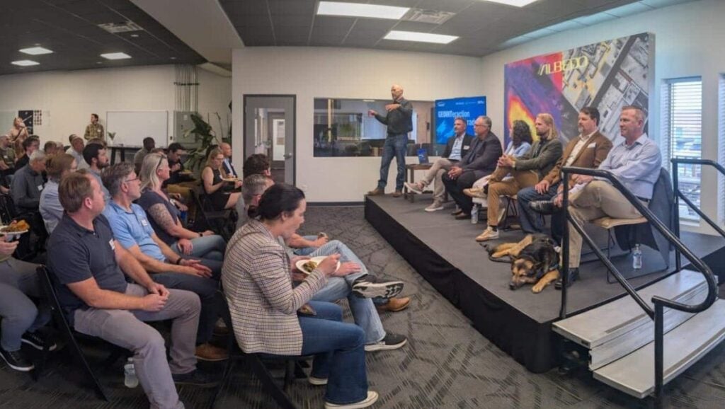
GEOINTeraction Colorado: Exploring Space-Based Thermal Insights
At USGIF’s June GEOINTeraction Colorado, USGIF’s Front Range Area Community (FRAC) of Interest gathered government and industry leaders for a discussion on spac…

USGIF Welcomes Civil Air Patrol
Herndon, Virginia (July 2, 2026) – The United States Geospatial Intelligence Foundation (USGIF) is pleased to announce Civil Air Patrol (CAP) has joined USGIF a…