
USGIF Collaborates with John Champe High School Students
Back in February, USGIF teamed up with John Champe High School in Aldie, Va. to assist in a research project that focused on identifying pollutants in Loudoun County.
USGIF Collaborates with John Champe: Back in February, USGIF teamed up with John Champe High School in Aldie, Va. to assist in a research project that focused on identifying pollutants in Loudoun County. Working with juniors and seniors in AP environmental science and computer science, USGIF gave students an overview of GEOINT and brought in volunteers from Esri to help them visualize their projects by using Esri’s StoryMaps.
Check out the video to get an in depth look at the project-based learning (PBL) project!
John Champe Pollution Story Maps from LCPS-TV on Vimeo.
Related Articles
Delta State University Earns USGIF Collegiate Accreditation
USGIF is pleased to announce Delta State University in Cleveland, Miss., has earned USGIF Collegiate Accreditation for its Geospatial Analysis and Intelligence…
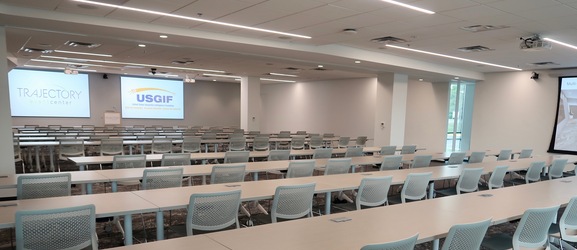
USGIF Opens State-of-the Art Trajectory Event Center
USGIF recently opened its own state-of-the-art event space, known as the Trajectory Event Center, in Herndon, Va.
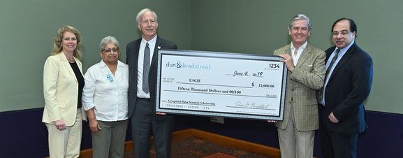
Foundation Announces New Scholarship in Partnership with Dun & Bradstreet
USGIF announced this week at its GEOINT 2019 Symposium that it has partnered with Dun & Bradstreet to offer a new academic scholarship to advance geospatial dat…